
Jacksonville, Fl. — The “Buresh Bottom Line”: Always be prepared!.....First Alert Hurricane Preparation Guide... City of Jacksonville Preparedness Guide... Georgia Hurricane Guide.
STAY INFORMED: Get the * FREE * First Alert Weather app
FREE NEWS UPDATES, ALERTS: Action News Jax app for Apple | For Android
WATCH “Preparing for the Storm”
WATCH “The Ins & Outs of Hurricane Season”
READ the First Alert Hurricane Center “Survival Guide”
LISTEN & WATCH “Surviving the Storm” - WOKV Radio & Action News Jax
***** ALWAYS CHECK & RE-CHECK THE LATEST FORECAST & UPDATES! *****
REMEMBER WHEN A TROPICAL STORM OR HURRICANE IS APPROACHING: Taping windows is *not* recommended & will not keep glass from breaking. Instead close curtains & blinds.
Realize the forecast cone (”cone of uncertainty”) is the average forecast error over a given time - out to 5 days - & *does not* indicate the width of the storm &/or where damage that might occur.

Low pressure over the Central Atlantic was upgraded to subtropical storm “Don”. early Friday. Subtropical means the low pressure area is not purely tropical without a completely warm core. A weak & disorganized Don will meander over the Central Atlantic through the week slowly making a loop before finally getting caught by a trough of low pressure turning the storm toward the north by next weekend. All the while, Don will remain over the open Atlantic - possibly flirting with becoming purely tropical - about midway between Bermuda & the Azores. There is a lot of dry air nearby + moderate to strong shear which will likely keep Don from becoming much stronger or could even cause degeneration into a remnant low. ln any case, no impacts to Jacksonville or any of the U.S.
In the longer range... there are indications of a possible strong tropical wave becoming a tropical cyclone over the far Eastern Atlantic within a week or so. Something to keep an eye on.


Water vapor loop (dark blue/yellow is dry mid & upper level air):


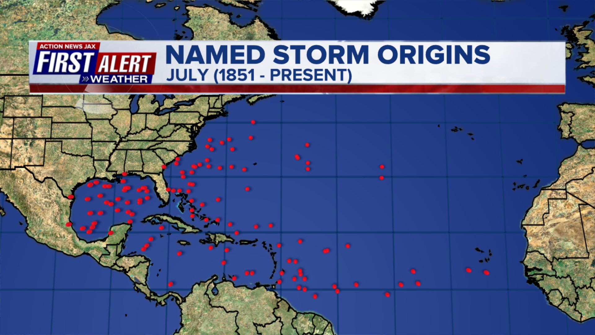
July tropical cyclone origins:
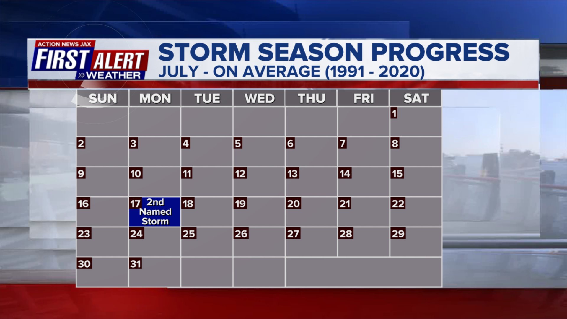
Averages below based on climatology for the Atlantic Basin for July (already at 3 named storms):

Wind shear:


Saharan dust spreads west each year from Africa by the prevailing winds (from east to west over the Atlantic). Dry air - yellow/orange/red/pink. Widespread dust is indicative of dry air that can impede the development of tropical cyclones. However, sometimes “wanna’ be” waves will just wait until they get to the other side of - or away from - the plume then try to develop if other conditions are favorable. In my personal opinion, way too much is made about the presence of Saharan dust & how it relates to tropical cyclones. In any case, the peak of Saharan dust typically is in June & July.

2023 names..... “Emily” is the next name on the Atlantic list (names are picked at random by the World Meteorological Organization... repeat every 6 years). Historic storms are retired [Florence & Michael in ’18... Dorian in ’19 & Laura, Eta & Iota in ‘20, Ida in ‘21 & Fiona & Ian in ‘22]). In fact, this year’s list of names is rather infamous with “Katrina”, “Rita” & “Wilma” retired from the ‘05 list & “Harvey”, “Irma”,“Maria” & “Nate” from the ‘17 list. The WMO decided - beginning in 2021 - that the Greek alphabet will be no longer used & instead there will be a supplemental list of names if the first list is exhausted (has only happened three times - 2005, 2020 & 2021). The naming of tropical cyclones began on a consistent basis in 1953. More on the history of naming tropical cyclones * here *.


East Atlantic:


Mid & upper level wind shear (enemy of tropical cyclones) analysis (CIMMS). The red lines indicate strong shear:

Water vapor imagery (dark blue indicates dry air):

Deep oceanic heat content over the Gulf, Caribbean & deep tropical Atlantic. The brighter colors will expand rather dramatically by Aug./Sept./Oct.:

Sea surface temp. anomalies:


SE U.S. surface map:

Surface analysis centered on the tropical Atlantic:

Surface analysis of the Gulf:

Caribbean:

GFS wave forecast at 48 & 72 hours (2 & 3 days):


Atlantic Basin wave period forecast for 24, 48 & 72 hours respectively:


East Pacific:
Calvin continues over the East Pacific & will slowly weaken through the upcoming week while moving west/NW. A weak Calvin will reach the Hawaiian Islands by late Tue. producing gusty squalls but should no longer be a significant system.


West Pacific:
“Talim” is expected to hit China by Tuesday:


Global tropical activity:


Cox Media Group


